 Conn Home
%) Topographical Survey's
Topographical Survey's%) Loan Survey's
Loan Survey's%) Subdivisions
Subdivisions%) Construction Staking
Construction Staking%) Boundary Survey's
Boundary Survey's%) ALTA Surveys
ALTA Surveys Examples
 Contact Us
 Links
Links Staff
Staff Work Order
 KR
KR File Sharing
Cadastral Survey:
Cadastral Survey is an operational program within the Bureau of Land Management, Department of the Interior whose mission and focus includes:
The practice of finding boundaries is neither a purely legal process, nor a purely scientific process. It is something in between with a twist. The boundary surveyor in finding an old survey must be cognizant of the legal description of the land and any conflicts which may affect it. This involves not only knowledge but skills in research and investigation. Then the surveyor must be part archeologist to find physical evidence of previous surveys and occupation on the ground. Throughout the process the surveyor must understand the concepts of good measurements to find and describe what is found, and be able to interpret it's relationship to the record. In the end those that do it well find it can be rewarding and fun, sort of as mathematical detective work, with archeology, dendrology, geology and paralegal aspects thrown in. So we sometimes use the old saying "Land Surveying" is both an art and a science.
Cadastral Survey is an operational program within the Bureau of Land Management, Department of the Interior whose mission and focus includes:
- Performing legal boundary surveys for the Federal Government. This includes consultation and boundary determination expertise for USFS, Park Service, Corps of Engineers, BIA, Fish and Wildlife Service, Bureau of Reclamation, etc
- Steward of PLSS records for all active Public Land States, descendant from original General Land Office, or the GLO, the creators of the Public Land Survey System.
- A 215 year history of getting the job done and practical innovation.
- Currently maintains offices in Alaska, Arizona, California, Colorado, GCDB Denver, Eastern States, Idaho, Montana, Nevada, New Mexico, Oregon, Utah , Washington D.C. and Wyoming.
- Produces and maintains the primary land tenure records: the survey field notes and plats.
- Is a leader in developing spatial data as a basis for National Land Information System. This includes a large data collection efforts which is underway, known as the GCDB or Geographic Coordinate Data Base Project. This is the largest project in the world for development of records based geographic spatial framework.
The practice of finding boundaries is neither a purely legal process, nor a purely scientific process. It is something in between with a twist. The boundary surveyor in finding an old survey must be cognizant of the legal description of the land and any conflicts which may affect it. This involves not only knowledge but skills in research and investigation. Then the surveyor must be part archeologist to find physical evidence of previous surveys and occupation on the ground. Throughout the process the surveyor must understand the concepts of good measurements to find and describe what is found, and be able to interpret it's relationship to the record. In the end those that do it well find it can be rewarding and fun, sort of as mathematical detective work, with archeology, dendrology, geology and paralegal aspects thrown in. So we sometimes use the old saying "Land Surveying" is both an art and a science.
Boundary Survey's
Click an image for larger
view

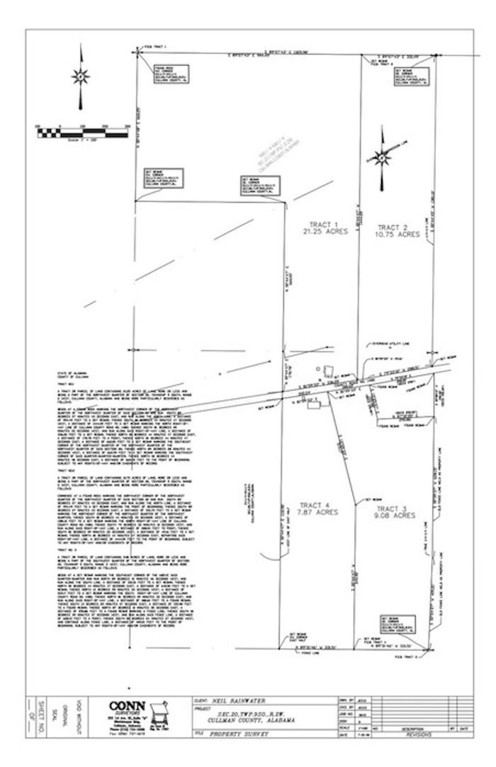
ALTA BOUNDARY
BOUNDARY DIVISION
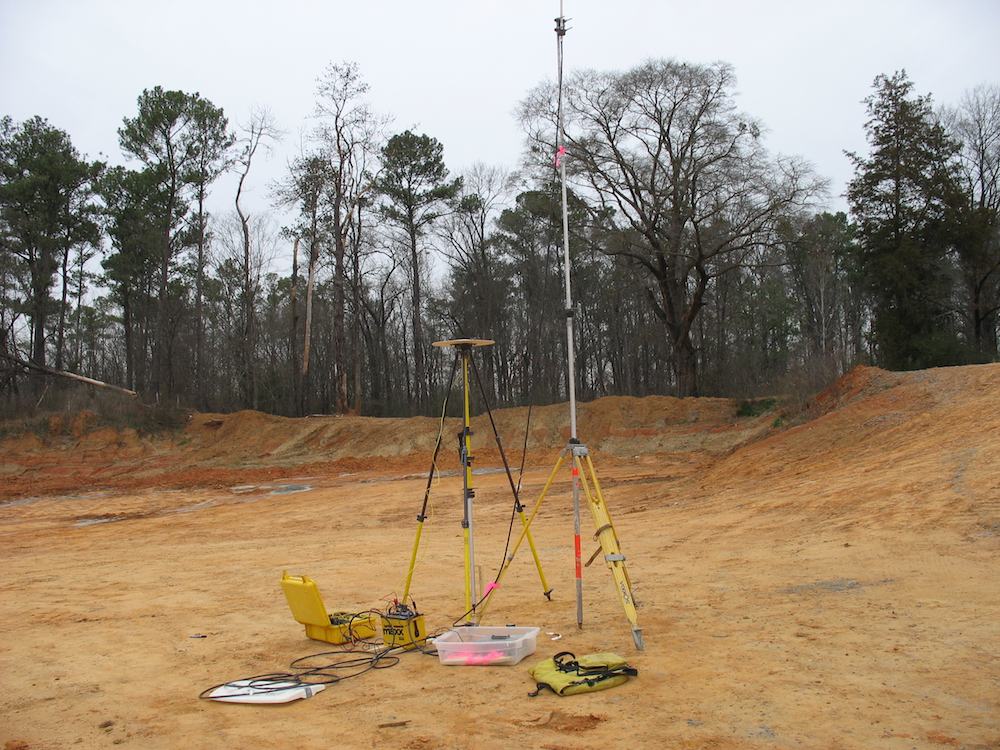
GPS BASE STATION