 Conn Home
%) Topographical Survey's
Topographical Survey's%) Loan Survey's
Loan Survey's%) Subdivisions
Subdivisions%) Construction Staking
Construction Staking%) Boundary Survey's
Boundary Survey's%) ALTA Surveys
ALTA Surveys Examples
 Contact Us
 Links
Links Staff
Staff Work Order
 KR
KR File Sharing
The purpose of a TOPOGRAPHIC SURVEYis to gather survey data about the natural and man-made features of the land, as well as itselevations. From this information a three-dimensional map may be prepared. You may prepare the topographic map in the office after collecting the field data or prepare it right away in the field by plane table. The work usually consists of the following:
1. Establishing horizontal and vertical controlthat will serve as the framework of the survey
2. Determining enough horizontal location and elevation (usually called side shots) of ground points to provide enough data for plotting when the map is prepared
3. Locating natural and man-made features that may be required by the purpose of the survey
4. Computing distances, angles, and elevations
5. Drawing the topographic map Topographic surveys are commonly identified with horizontal and/or vertical control of third- and lower-order accuracies .
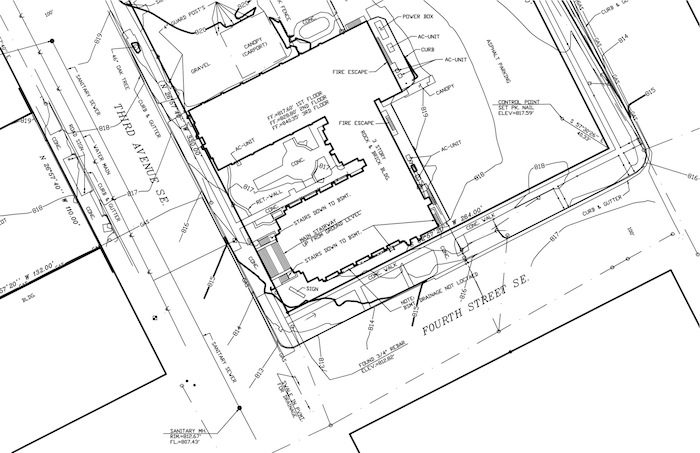
Topographical
Survey:
Click an image for larger
view